SFGAmWorld.com
Untitled Document
Park Information
Latest News
Great America
Roller Coasters
Rides
Hurricane Harbor
Water Slides
Water Attractions
Advertisement

Severe Weather Possible

A Off-Topic forum to discuss things that aren't related to the Amusement Park Industry.
Postby Galvan on July 10th, 2008, 1:24 pm
National Weather service has just issued a Severe Thunderstorm watch for all of the Chicagoland Area until 10pm.

More info as it becomes available.
Image
Galvan
Moderator

User avatar
 
Posts: 3639
Joined: June 30th, 2003, 1:23 am
Location: Montgomery,IL

Postby [jonrev] on July 10th, 2008, 6:46 pm
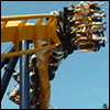
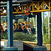
So much for coasters after dark tonight...
[jonrev]

User avatar
 
Posts: 3724
Images: 0
Joined: April 21st, 2003, 11:40 am
Location: Lake Wazzapamani

Postby DejaVuGurl1203 on July 10th, 2008, 7:04 pm
Wish I was there. :lol:
DejaVuGurl1203

User avatar
 
Posts: 4181
Joined: December 28th, 2002, 8:35 pm
Location: Illinois

Postby bigb7965 on July 10th, 2008, 7:37 pm
my brother is there right now

my dad called him 2 minutes ago

hes soaked :lol:
"Prepare for launch. Goodbye"

My Coaster Counter
bigb7965

User avatar
 
Posts: 589
Joined: January 5th, 2008, 8:48 pm
Location: Bolingbrook, IL

Postby Galvan on July 10th, 2008, 8:10 pm
BULLETIN - EAS ACTIVATION REQUESTED
SEVERE THUNDERSTORM WARNING
NATIONAL WEATHER SERVICE CHICAGO/ROMEOVILLE IL
756 PM CDT THU JUL 10 2008

THE NATIONAL WEATHER SERVICE IN CHICAGO HAS ISSUED A

* SEVERE THUNDERSTORM WARNING FOR...
COOK COUNTY IN NORTHEAST ILLINOIS...
DUPAGE COUNTY IN NORTHEAST ILLINOIS...

* UNTIL 845 PM CDT...

* AT 756 PM CDT...NATIONAL WEATHER SERVICE RADAR INDICATED A LINE OF
SEVERE THUNDERSTORMS LOCATED ALONG A LINE EXTENDING FROM
WARRENVILLE TO BELLWOOD TO EVANSTON...AND MOVING SOUTHEAST AT 31
MPH. THESE STORMS ARE CAPABLE OF PRODUCING PENNY SIZE HAIL...AND
DAMAGING WINDS IN EXCESS OF 60 MPH.

* SEVERE THUNDERSTORMS WILL BE NEAR...
WESTMONT...WESTERN SPRINGS...RIVERSIDE BY 800 PM...
WOODRIDGE...SUMMIT...STICKNEY...NAVY PIER...DOWNTOWN CHICAGO BY 805 PM...
WILLOW SPRINGS...MIDWAY AIRPORT...AND COUNTRYSIDE BY 810 PM...
PALOS PARK...OAK LAWN...AND HYDE PARK BY 825 PM...

THIS SEVERE THUNDERSTORM WARNING INCLUDES THE CITY OF CHICAGO
Image
Galvan
Moderator

User avatar
 
Posts: 3639
Joined: June 30th, 2003, 1:23 am
Location: Montgomery,IL

Postby frightfestkid on July 11th, 2008, 11:11 am
CAD rocked, befor CAD started, i got wet and so did people... HURRAY FOR PUDDLES!
God bless NIU
Next SFGAm trip: Today May 1st
SFGAm '10 ride count-53
frightfestkid

User avatar
 
Posts: 397
Joined: September 25th, 2007, 4:24 pm
Location: where I am.

Postby Jackluver18 on July 11th, 2008, 12:05 pm
The weather ruined my CAD which made me mad, stupid weather people. It was only suppose to rain 30%, that's bull.
SF trips 09 = 15
SF trips 10= 11
SF trips 11 =7
Jackluver18

User avatar
 
Posts: 2776
Joined: October 16th, 2005, 12:54 am
Location: Moved from X-Flight's station to Bull.


Return to Off-Topic Forum

Who is online

Users browsing this forum: No registered users and 5 guests

Privacy Policy About Us Copyright Disclaimer E-Mail SFGAmWorld
COPYRIGHT - SFGAmWorld.com
All content and images on this site are Copyright 2001 - SFGAmWorld.com and may not be used without permission.
This is NOT the official site of Six Flags Great America, SFGAmWorld.com is not affilated or endorsed by Six Flags Great America.
SFGAmWorld.com does not make any guarantee on the accuracy of the information on this website and cannot be held responsible by the use of this information.
SIX FLAGS and all related indicia are trademarks of Six Flags Theme Parks Inc. ®, TM and © . The official Six Flags site can be found at SixFlags.com
BATMAN, SUPERMAN and all related characters and elements are trademarks of © DC Comics.
LOONEY TUNES and all related characters and elements are trademarks of and © Warner Bros. Entertainment Inc.©
The Wiggles Pty Ltd. SCOOBY-DOO and all related characters and elements are trademarks of and © Hanna-Barbera.

cron